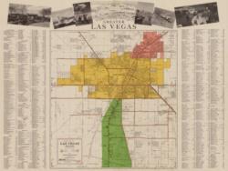
The map collection dates from the early exploration of Nevada and the Southwest to the present.
The collection includes:
- A series of nineteenth century military and railroad surveys and atlases
- Later state railroad maps
- Highway maps
- Topographical survey maps
- Official U.S. surveys as well as those created or annotated by individual geologists, hydrogeologists, and engineers
Other significant material in the map collection include:
- A comprehensive series of Las Vegas city maps
- Government land office surveys and plats (including the original U.S. Land Office survey maps of Clark County)
- Plats and site plans created by real estate developers
- Physical and topographic maps of Clark County


